


TALLAHASSEE, Fla. (WTXL) — Considerable cloudiness and batches of showers and rain have held afternoon temps in check across most Florida/Georgia state line region, with manageable rainfall amounts and a limit on strong thunderstorms. The pattern of southeast wind will continue to support layers of clouds and passing showers through the early part of the night.
Temperatures will go from the 80s to the 70s in the mid-evening, on their way to steady readings in the mid 70s just after midnight.
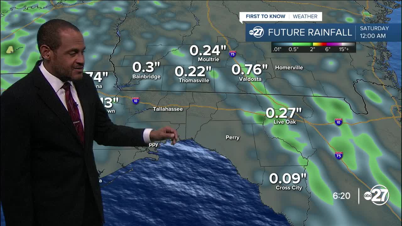
The moist flow keeps going on Friday. After a few hours of heating, showers and thunderstorms will start popping by early afternoon and move in the similar northwesterly fashion, affecting most central and western Big Bend and southwestern Georgia neighborhoods with a dose of dampness. Partial sunshine will be seen by all, with highs in the low to mid 90s and feels-like values near of just above 100°.
The days over the weekend will have ample sun and a few hit-or-miss variety of daytime rain and thunder, but stronger high pressure will rebuild over the Southeast early next week. This will be the source of very hot conditions returning to the region, with highs Sunday through Tuesday around or above 100° and heat index readings over 110°, likely causing the need for heat advisories on several of those days. Rain activity will be confined to the sea breeze before some clusters of rain and storms move in late Tuesday and influence a revival of the daily rain cycle by the middle of next week.
--Casanova Nurse, Chief Meteorologist
Want to see more local news? Visit the WTXL ABC 27 Website.
Stay in touch with us anywhere, anytime.
