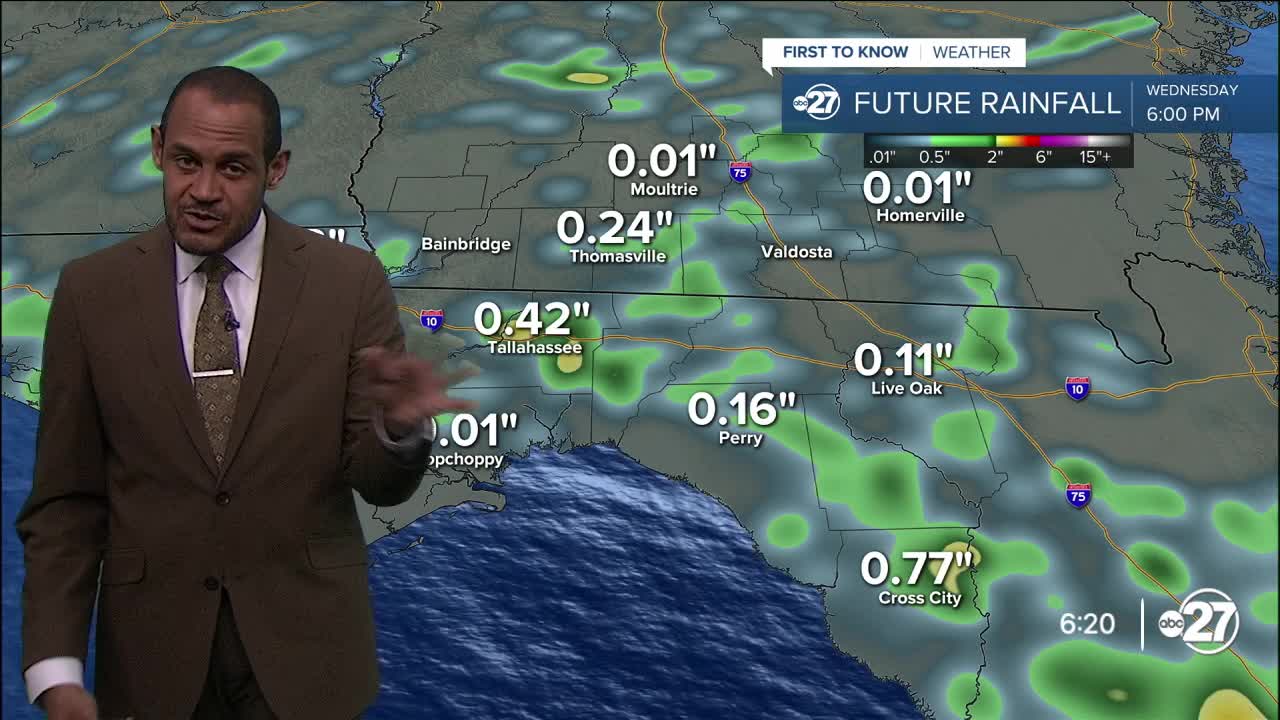


TALLAHASSEE, Fla. (WTXL) — While late-day showers and storms are becoming numerous, they are affecting different areas at different times, so there are still some neighborhoods that haven't encounter rain action yet. Time still remains through the evening and early nighttime hours for a period of rain and lightning around the state line counties. Severe weather is not expected but the thunder can get loud and the ground can get soggy quickly.
Overnight temps will be in the mid 70s for lows with scattered clouds.
The disturbance in the northern Gulf will keep moving west Thursday, putting our area in a southeast wind pattern. Mugginess will continue along with clouds, breaks of sun, and developing waves of scattered showers and thunderstorms that will move to the northwest. Forecast highs will be around 90° to the lower 90s, with warmer readings in the I-75 corridor.
The afternoon shower and storm cycle will resemble average summer levels of activity through Saturday. By then, high pressure that drove up local temperatures last weekend will be setting up here again for a few days next week. It will push highs closer to 100° for at least three days (Sunday through Tuesday) with limited rain opportunities. The heat backs off a touch by midweek with the daily thunderstorm routine resuming.
--Casanova Nurse, Chief Meteorologist
Want to see more local news? Visit the WTXL ABC 27 Website.
Stay in touch with us anywhere, anytime.
