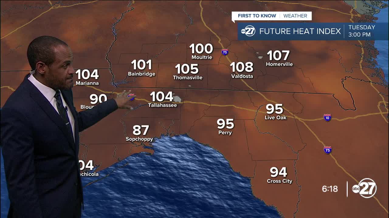


TALLAHASSEE, Fla. (WTXL) — With a reduced amount of local showers and storms compared to what was forecast, late-afternoon temps around the state line are flirting with 100° while feels-like values have been around or above 110° again. For areas that continue to go without rain action this evening, those 90s are going to stretch for maybe an hour or so after sunset in the warmest locations.
As the sky clears late tonight, the high amounts of moisture in the air will slow the cooling trend, so the 80s will go deep into the early morning hours of Tuesday. Eventual lows will level off in the mid to upper 70s.
As the high-pressure zone supporting this current heat spell shifts and weakens slightly, a batch of moisture and general lower pressure to our east will scoot closer Tuesday through midweek. This begins a transition to seeing more development of daytime rain and thunderstorms, with a gradual increase experienced Tuesday afternoon, especially in eastern areas near I-75 and thereabouts. Some of the storms in that region will be gusty with possible hail and severe storm warnings.
Highs Tuesday will range from the low to mid 90s east to the upper 90s west. Feels-like readings will get close to the heat advisory level again, especially in the tri-state.
While Wednesday will still have some sunshine, areas of showers and storms will be more common area-wide. It'll be occasionally damp to close out the work week. Highs will be closer to average in the lower 90s during that period before the weekend heats up again with less rain activity expected.
—Casanova Nurse, Chief Meteorologist
Want to see more local news? Visit the WTXL ABC 27 Website.
Stay in touch with us anywhere, anytime.
