

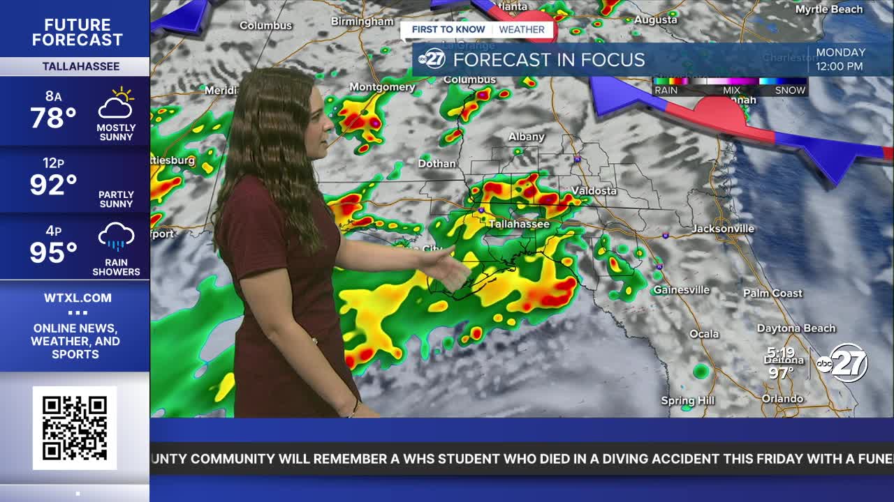


TALLAHASSEE, Fla. (WTXL) — A low and attached front to our north will contribute to another round of scattered to numerous showers and storms throughout both Monday and Tuesday.
Activity could start as early as 8-9 a.m. for western counties as it moves towards the east/northeast, developing and strengthening as it does so. Excessive rainfall is possible as we have had days of consistent rain. Totals of 1-2" are expected with isolated neighborhoods reaching upwards of 2 - 3.5".
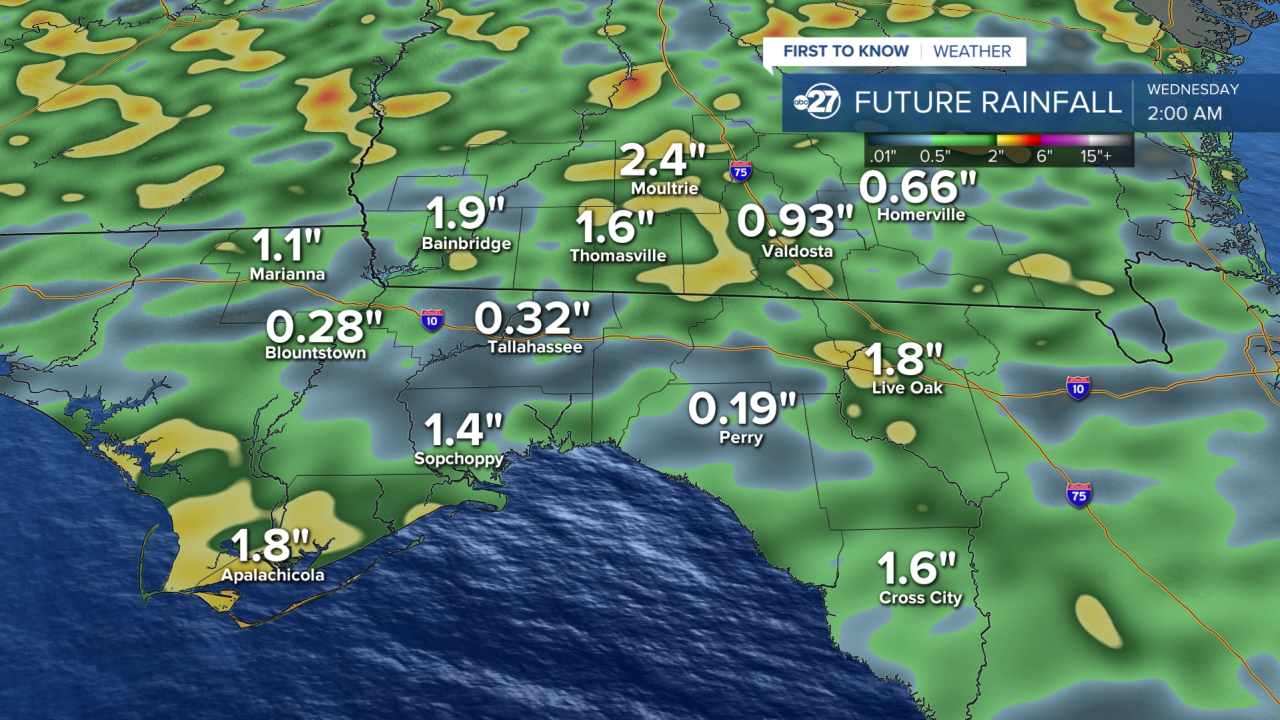
Strong storms are in store throughout the afternoon with gusty winds, heavy downpours, and frequent lightning being the main concerns. However, the chance for severe storms is lower for Monday.
The cloud cover and rainfall will help keep daytime highs in the upper 80s for most.
The low pressure will hang around to our north before finally drifting west come mid week which will allow us to return to a more summer-like pattern. We will keep the showers and storms, but take the coverage down a notch while increasing daytime highs back to the low to mid 90s.
Stay dry!
Want to see more local news? Visit the WTXL ABC 27 Website.
Stay in touch with us anywhere, anytime.
