


TALLAHASSEE, Fla. (WTXL) — The weather pattern locally is settling down, eventually featuring less of an opportunity for showers and thunderstorms. A few do exist this evening across inland locations, with activity remaining spotty as it moves mostly to the north. Some areas of rain may stretch late into the night near the Chattahoochee River.
In areas that go without rain, early-evening temps near 90° will fall into the 70s around or just after midnight. Morning lows under a mostly clear sky will be in the mid 70s.
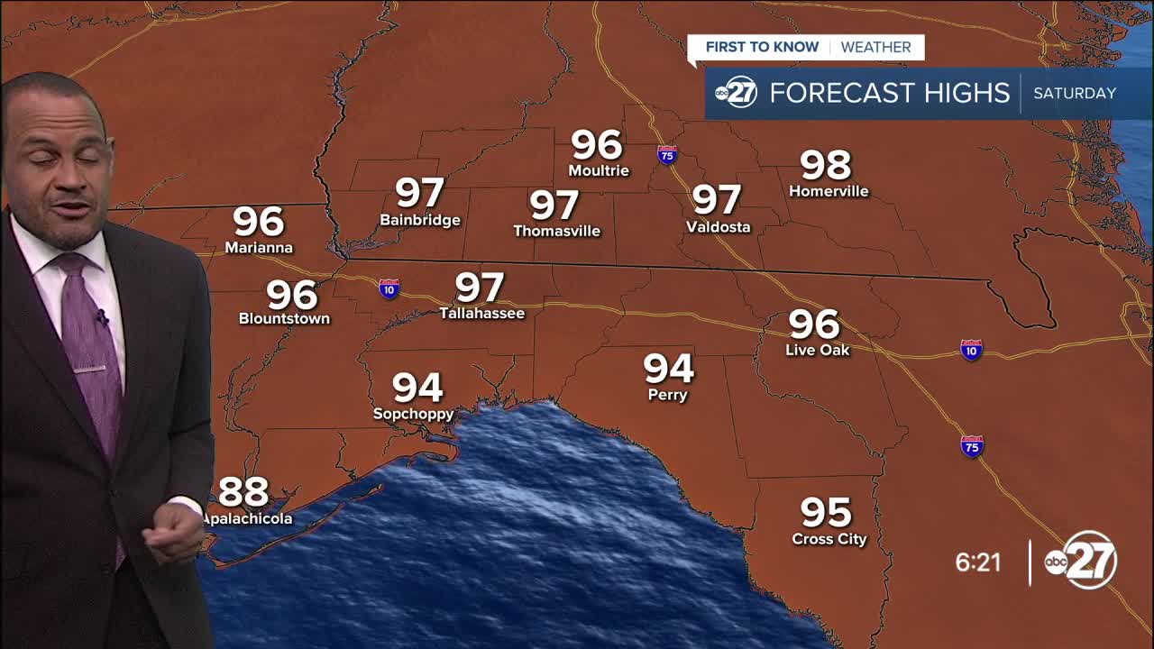
A zone of high pressure will stretch across Florida and the eastern Gulf region this weekend. High pressure causes fewer daytime showers and storms, and, coupled with a southwest to west wind pattern, afternoon readings will get support to rise steadily into the upper 90s. The high amounts of moisture mean those feels-like temperatures will flirt with heat-advisory levels around 107° to 112°. The same holds true for Sunday.
Rain development will be isolated and brief, with the sea breeze and extra heat allowing a few clouds to build enough to cause short-duration showers.
The deepest moisture — some of which contained in the former tropical disturbance that moved across the Gulf this week — will rotate around the high-pressure zone and re-emerge into the western Atlantic starting next Tuesday. While it's not being shown to re-develop into a low-pressure disturbance, we can have its moisture return to the area to create higher coverage of clouds, showers, and thunderstorms around midweek.
--Casanova Nurse, Chief Meteorologist
Want to see more local news? Visit the WTXL ABC 27 Website.
Stay in touch with us anywhere, anytime.
