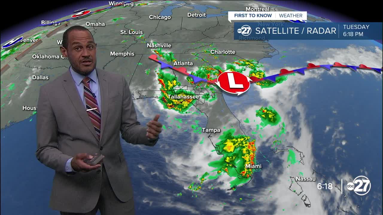


TALLAHASSEE, Fla. (WTXL) — A corridor of rain and thunderstorms has pushed through most local counties, breaking the extreme heat and providing cooling and dampening relief for areas affected. Tonight's weather setup supports lingering clouds, some leftover showers, and a chance for another batch of rain and thunderstorms to cross over local territory in the pre-dawn hours of Wednesday. Severe weather chances are generally low, but claps of thunder can startle some sleepers.
Evening temperatures will be generally in the 70s and 80s. Periodic cloudiness and deep moisture will hold temps steady overnight in the middle 70s.
Highs Wednesday will top out in the lower 90s, aided by breaks of sunshine in the morning before scattered showers and storms are produced in the tropical moisture field. An associated spin of low pressure will enhance the coverage and development of rain, causing times of downpours and locally excessive rainfall. Flooding will be spotty and not widespread.
The moisture and unsettledness will persist through Thursday. Friday features the departure of these features and a transition back to drier and hotter trends for the weekend and beyond. With another high-pressure ridge setting up by Sunday, our highs will be on the verge of 100° again, and heat advisories would likely become necessary for a few days next week.
--Casanova Nurse, Chief Meteorologist
Want to see more local news? Visit the WTXL ABC 27 Website.
Stay in touch with us anywhere, anytime.
