


TALLAHASSEE, Fla. (WTXL) — The drier-than-usual air mass remains in place around the state line region, keeping cloud cover minimal and comfort levels higher in many cases. Warm late-day temperatures will have an easier time falling through the 80s and into the 70s this evening. Areas of clear sky and patchy clouds are forecast overnight with eventual lows in the mid 60s north to near 70° in the Big Bend and southeastern sections.
A north to west wind Thursday will be on the lighter side but will support steady warming with a mostly sunny to partly cloudy sky throughout the day. Forecast highs will be in the lower 90s, not far from average. The muggy factor won't be all that high Thursday, so the heat index won't be much different than the actual air temperature.
The east coast sea breeze can activate a couple of showers for the I-75 counties and points east Thursday afternoon. Elsewhere, it will remain dry.
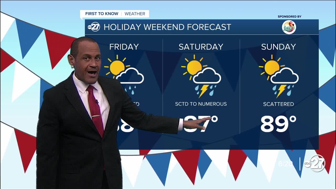
The upper-level pattern will bring in a disturbance from the west Friday and this weekend. Local moisture amounts will increase and bring about times of broader cloudiness and a few showers by Friday late-afternoon. This active setup promotes more clouds and occasional showers, rain, and few thunderstorms Saturday, including during times of day when college football activities will be taking place. It won't be raining the entire time, though, and the thunderstorm risk is in an isolated to spotty range.
The extra cloud cover will help hold weekend high temperatures in the mid to upper 80s, a trend that continues into Labor Day Monday, as well.
--Casanova Nurse, Chief Meteorologist
Want to see more local news? Visit the WTXL ABC 27 Website.
Stay in touch with us anywhere, anytime.
