


TALLAHASSEE, Fla. (WTXL) — As the drier air moves into the state line region on a sustained northeast wind pattern, the local humidity levels will continue to fall while raindrops have ceased to fall on the local landscape.
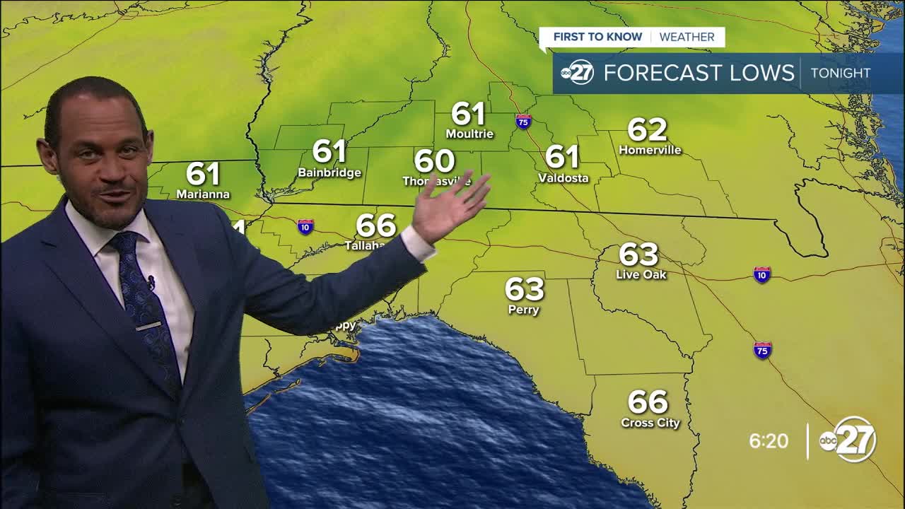
Upper clouds streaming overhead from the Gulf will not create rain opportunities but can keep some areas from being completely clear this evening. Regardless of the amounts of upper cloud cover, area temperatures will drop from the upper 80s to the 70s quickly this evening, with 60s showing up on most area thermometers overnight. Thursday morning lows will be in the lower 60s north of US 84 in southern Georgia with mid 60s across most other inland neighborhoods. Coastal zones will be closer to 70°.
We'll see times of sunshine and the veil of mid and high clouds casting a filter on the sunlight on occasion, but it's a setup that supports a zero rain chance and amount of anticipated coverage. It'll be nearly perfect for making progress on outdoor work and projects. The afternoon will still be fairly warm, but close to average around 90°, but the moisture levels will remain low and the muggy factor won't be overly overwhelming.
The dry stretch of days continues straight through the weekend with a steady temperature trend of lows in the 60s and highs near and around 90°. A few clouds can gather along the coastal sea breeze, but the chances for rain will remain close to or at zero. The deepest moisture in the peninsula of Florida is expected to remain suppressed to our south into early next week. It may be a week before any noticeable rain opportunity returns to the Big Bend region.
--Casanova Nurse, Chief Meteorologist
Want to see more local news? Visit the WTXL ABC 27 Website.
Stay in touch with us anywhere, anytime.
