


TALLAHASSEE, Fla. (WTXL) — The high-pressure setup today has pushed afternoon temps well into the 90s with heat index values around 104° to 113°, easily verifying the need for current heat advisories in most local counties until early this evening. A stray shower or storm is possible along the sea breeze flow just inland from the coast, as well as in interior southern Georgia near US 82, but overall rain prospects today remain slim.
Evening readings will fall out of the 90s after 7 p.m. The 80s linger through midnight. The sky will be mostly clear when we get into the 70s, with sunrise lows in the mid 70s.
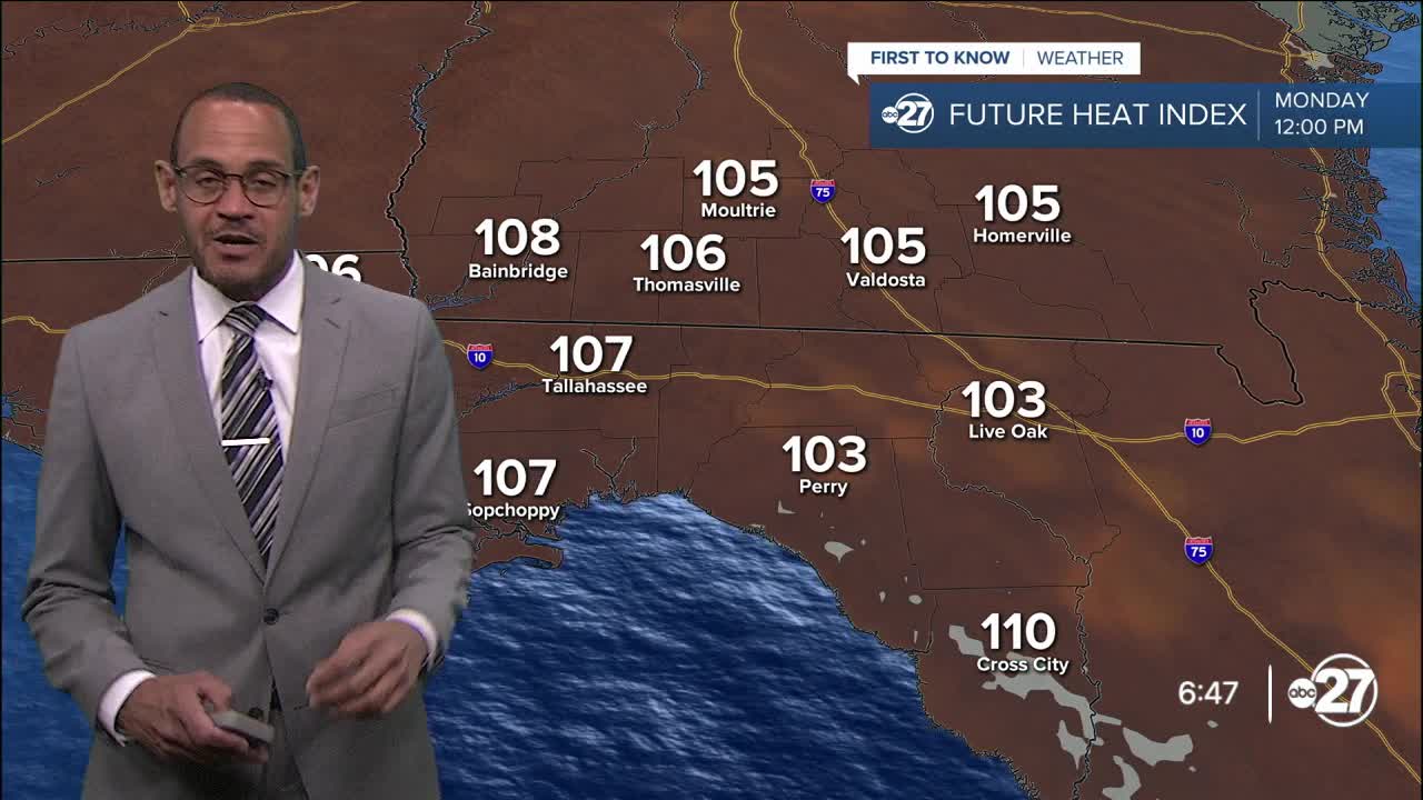
High pressure starts shifting and weakening a tad Monday, not quite enough to prevent highs in the mid to upper 90s again with a chance for another round of heat advisories. But a few more scattered showers and storms are expected in the afternoon, particularly in the eastern Big Bend and south-central Georgia where the activity is more favored to develop. Deeper tropical moisture returns by midweek with a more unsettled atmospheric pattern that will support more cloudiness, periods of rain and thunder, and high temperatures nearer to the average of the lower 90s.
—Casanova Nurse, Chief Meteorologist
Want to see more local news? Visit the WTXL ABC 27 Website.
Stay in touch with us anywhere, anytime.
