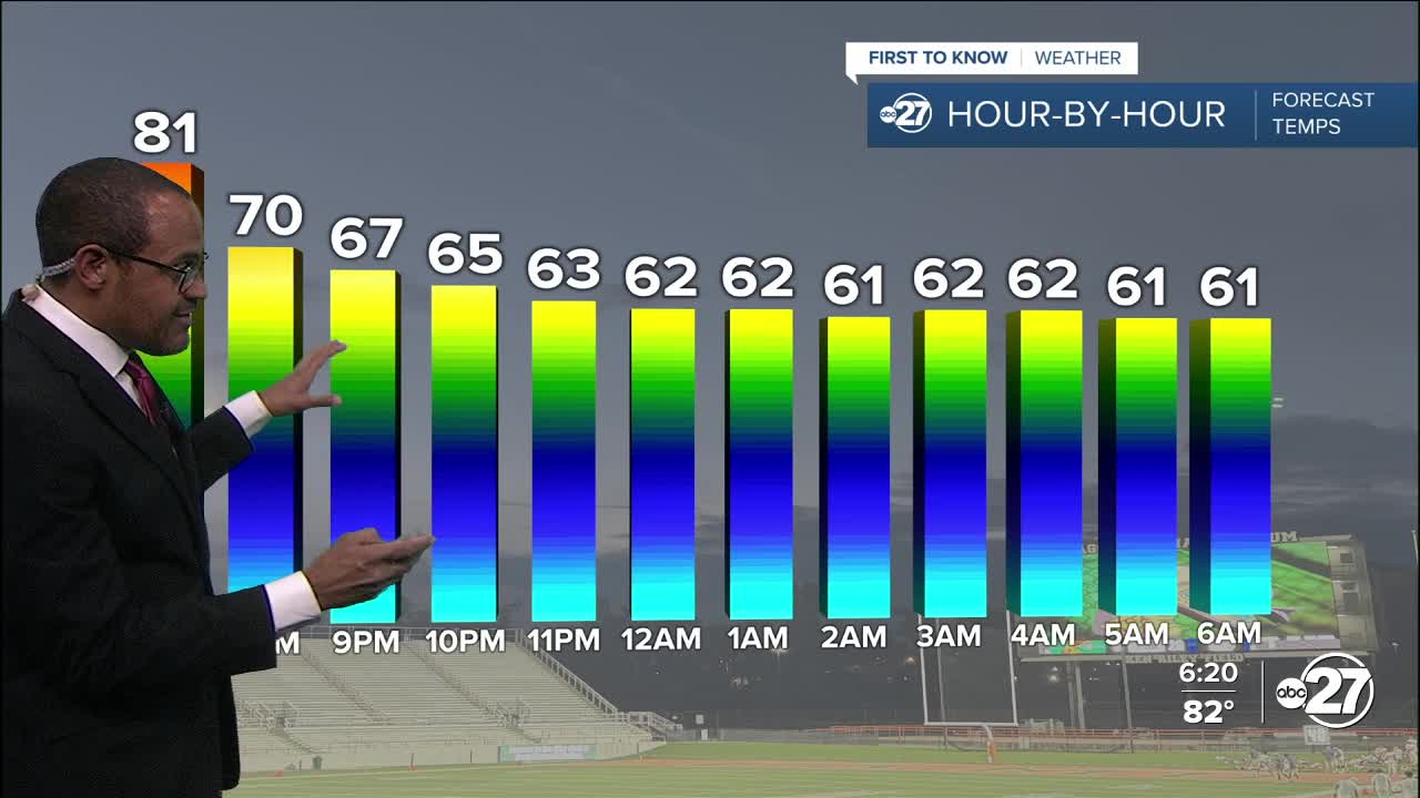


TALLAHASSEE, Fla. (WTXL) — An approaching cold front late tonight and Wednesday morning won't stir up things much more beyond a veil of clouds overnight, which can affect how cool nighttime readings may get. There's not enough moisture around for showers and storms, but partial cloudiness can slow down or otherwise interfere with the cooling trend tonight. There's a decent chance that overnight lows can be achieved early in the night, near the mid and upper 50s shortly after midnight, before temps level off or slightly rise toward 60° by sunrise.
Clouds will break as the front moves to the east and southeast Wednesday midday. Sunshine will be increasing, as well temperatures, peaking in the lower 80s with a light west to northwest wind.
This front simply reinforces the dry nature of the air, allowing for chillier mornings through Friday with lows in the 40s away from the coastline. Daytime highs will return to the 80° mark or thereabouts each afternoon through Saturday. It will be primarily sunny for the remainder of the work week, with a few more clouds on Saturday.
For the parched landscape, the next best rain chance arrives Sunday and Monday with another system that will swing through.
--Casanova Nurse, Chief Meteorologist
Want to see more local news? Visit the WTXL ABC 27 Website.
Stay in touch with us anywhere, anytime.
