


TALLAHASSEE, Fla. (WTXL) — Today's cold front has cleared out the bulk of the scattered clouds that were present earlier, so we are setting up once more for a colder evening with a clear trend in the sky.
Evening readings will go from near 80° early to the 60s before midnight. It's possible to have the 50s showing up before midnight inland, or in areas where there is no wind.
Morning lows will be in the mid 40s to around 50° in most areas away from bodies of water.
Glorious sunshine will be seen throughout Thursday morning and afternoon, with a chance for a few patchy clouds but nothing more. The abundant sun will aid in bumping up highs to the lower 80s by mid-afternoon.
Friday features the ongoing influence of nearby high pressure in the Southeastern U.S. and the continuation of a sunshiny sky with lows in the 40s and highs in the 80s. Saturday will also be dry, with slightly milder morning lows.
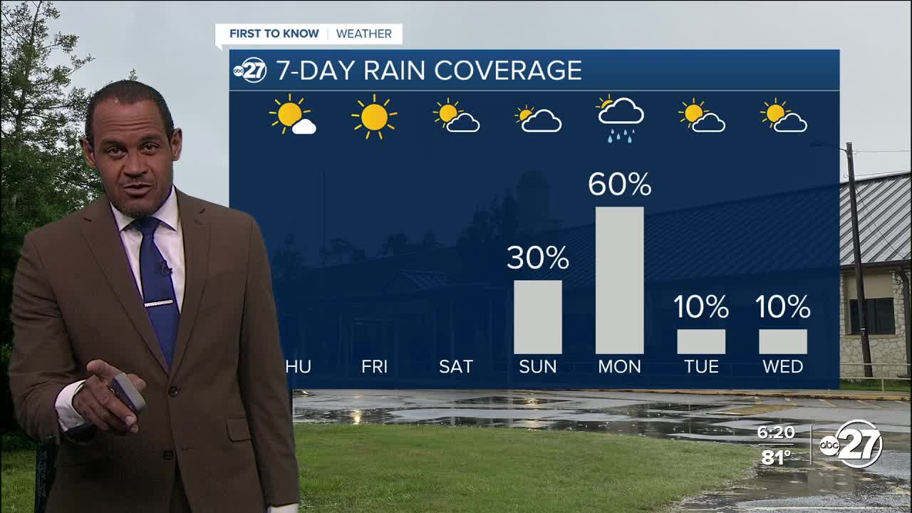
The next best rain chance comes late Sunday and Monday, with isolated thunderstorms in the mix.
--Casanova Nurse, Chief Meteorologist
Want to see more local news? Visit the WTXL ABC 27 Website.
Stay in touch with us anywhere, anytime.
