


TALLAHASSEE, Fla. (WTXL) — Patchy, spotty clouds this evening are unlikely to cause rain, and unlikely to linger much beyond sunset. The air around us is still rather dry and doesn't support robust evening shower development. An isolated case of a spot shower is possible through 9:00 p.m. Otherwise, it will be mostly clear to clear through sunrise Saturday.
Forecast readings will go from around 90° at the start of the evening to the 70s at midnight, on their way to low around the 70° mark at dawn.
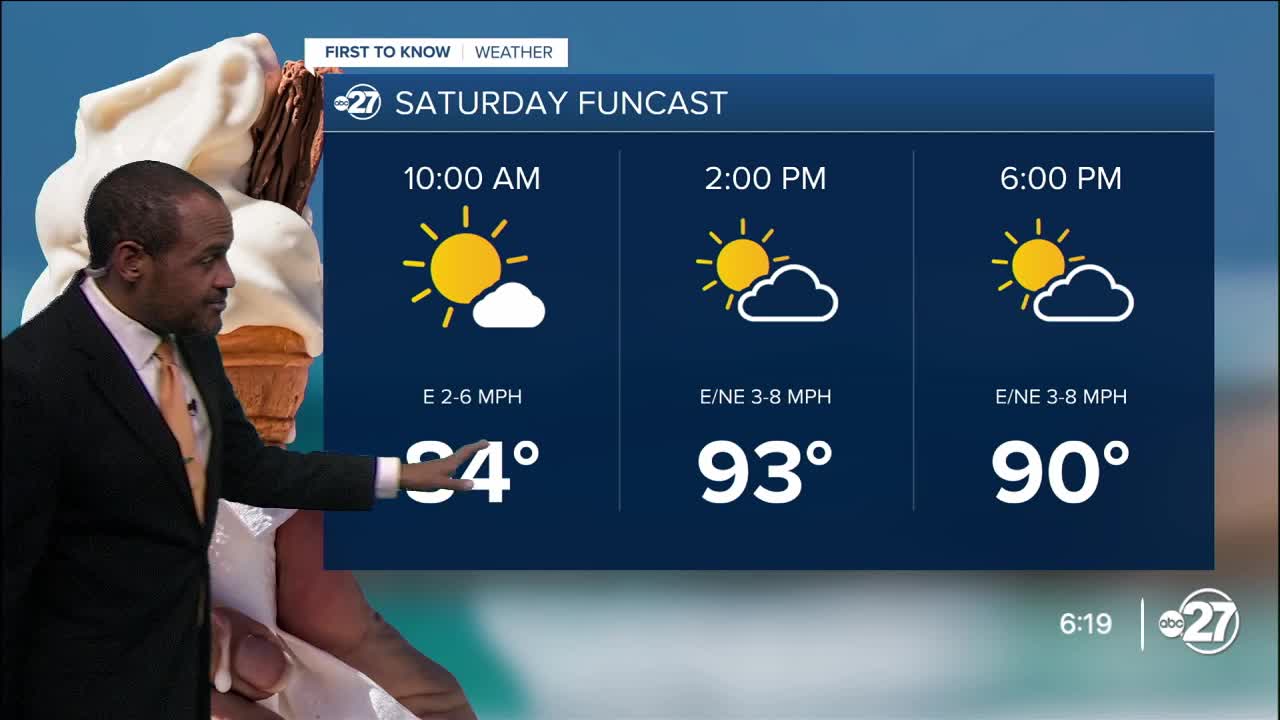
Sufficient sunshine will promote steady warming through midday with temps rising into the 80s and reaching the 90s early in the afternoon. Most areas will top out in the mid 90s for highs. The sky will be partly cloudy by afternoon. A chance for a few more showers and isolated thunderstorms will exist along the Big Bend coast and in the Suwannee River valley.
As a front to our north gets shoved our way Sunday, our temperatures will be minimally changed. But the presence of the front itself is able to kick off a few more showers and a couple of storms, particularly in the eastern Big Bend.
This front will likely linger in central and eastern areas of our region for a few days early next week, so the expectation is for more frequent rain activity to be experienced around and east of Highway 319, and lesser amounts of rain and thunder for the western and tri-state areas.
--Casanova Nurse, Chief Meteorologist
Want to see more local news? Visit the WTXL ABC 27 Website.
Stay in touch with us anywhere, anytime.
