


TALLAHASSEE, Fla. (WTXL) — It's a teaser of a fall pattern for us. The weekend cold front has shifted south into the Florida peninsula, and our local winds are becoming northwest to north. The drier air coming on those winds will displace the moisture and spotty showers present along the coast and the southeastern Big Bend through later tonight and triggering a clearing trend in most locations overnight.
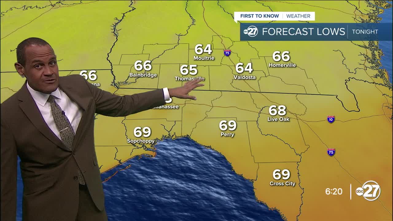
Evening temperatures will be in the upper 80s, falling into the 70s after sunset. The cooling trend will be more pronounced over southern Georgia in the morning, where lows will be in the mid 60s with upper 60s for lows in northern Florida by sunrise.
We'll have broad sunshine across the area Tuesday with passing clouds in the afternoon. The air will be remarkably dry, meaning it won't be very humid in the heat of the afternoon and there won't be much support for pop-up showers or storms. An isolated one is possible at the immediate coast, but even that appears less than likely with the stable conditions expected.
Highs Tuesday will still be hot, with low to mid 90s projected.
The dry air remains in place through Wednesday and Thursday. The coolest times will be around sunrise, in the 60s away from the coast. Daytime highs will still be in the 90s, but there won't be much of a heat index (feels-like) concern.
Moisture gathers by the end of the week with a still-active upper-level pattern that keeps highs from getting to hot. Shower coverage and development will increase over the upcoming Labor Day weekend, but it does not appear to cause washout conditions at this point in time.
—Casanova Nurse, Chief Meteorologist
Want to see more local news? Visit the WTXL ABC 27 Website.
Stay in touch with us anywhere, anytime.
