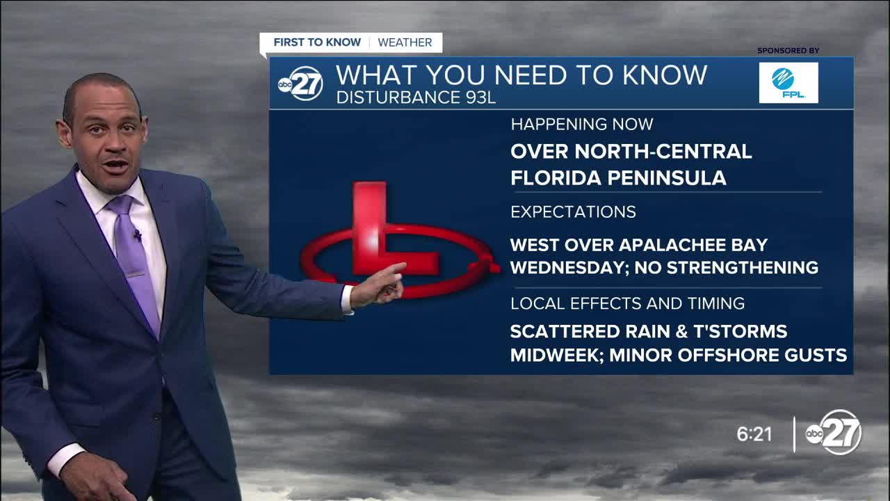


TALLAHASSEE, Fla. (WTXL) — Today's rain coverage will behave in similar fashion to yesterday's — isolated through early evening, then picking up a bit around and after sunset with a scattering of rain and storms coming in from eastern sections. Some of that activity is prompted by the swirl of tropical low pressure over north-central Florida this evening.
That system will enhance local rain action a bit, but not create overly adverse or rough weather conditions for the area Wednesday. There is a better chance for early-morning showers and rain for areas near the Big Bend coast, promoting scattered activity that moves inland through the late-morning and afternoon hours. Rain coverage is more spotty in southern Georgia, where rain totals are expected to be well less than one inch. Accumulations near and south of I-10 can be upwards of one inch, with isolated higher amounts possible.
Lows tonight will be in the mid 70s, and highs Wednesday will be in the upper 80s to lower 90s.
The disturbance will remain to our south as it moves west across the northern Gulf in the last half of this week. Its effects on our weather pattern will decrease. Near-average daily rain opportunities will be in place through Friday with highs in the low to mid 90s. High pressure positions itself south of us over the weekend to prompt a bump-up in expected highs to the upper 90s and a slight reduction in the daytime rain cycle.
--Casanova Nurse, Chief Meteorologist
Want to see more local news? Visit the WTXL ABC 27 Website.
Stay in touch with us anywhere, anytime.
