


TALLAHASSEE, Fla. (WTXL) — Clouds are gathering across tri-state counties, where evening shower chances are still small, but at their highest in comparison to the remainder of the state line region. A cold front is slipping southeastward toward the region and will contribute to lingering clouds and spotty showers this evening through tonight. Rain coverage will not be particularly widespread, and active storms are not anticipated, but it may be tougher to have a clearer sky straight through sunrise.
Evening readings will fall gradually through the 80s and enter the 70s this evening, with morning lows in the lower 70s in most areas. We can see some upper 60s around the Flint River region.
The front will keep moving southeast through Thursday, carrying any excessive cloud cover and occasional showers along with it into the eastern Big Bend. Clouds will be slow to break elsewhere but a partly cloudy scene is likely to emerge in inland areas through the afternoon. Forecast highs will be in the low to mid 80s.
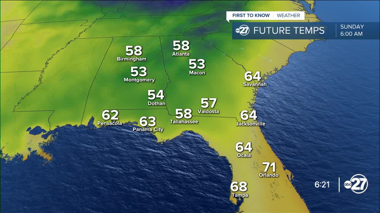
The drier (less humid) trend will become more noticeable by Friday morning as the sky goes into a clearing trend and lows start in the low to mid 60s. Highs will be in the lower 80s into the weekend. A disturbance off the east coast will enhance the dry flow locally, leading to lows in the 50s starting Sunday morning and lasting for a few days. Highs will remain in the low to mid 80s with broad sunshine.
--Casanova Nurse, Chief Meteorologist
Want to see more local news? Visit the WTXL ABC 27 Website.
Stay in touch with us anywhere, anytime.
