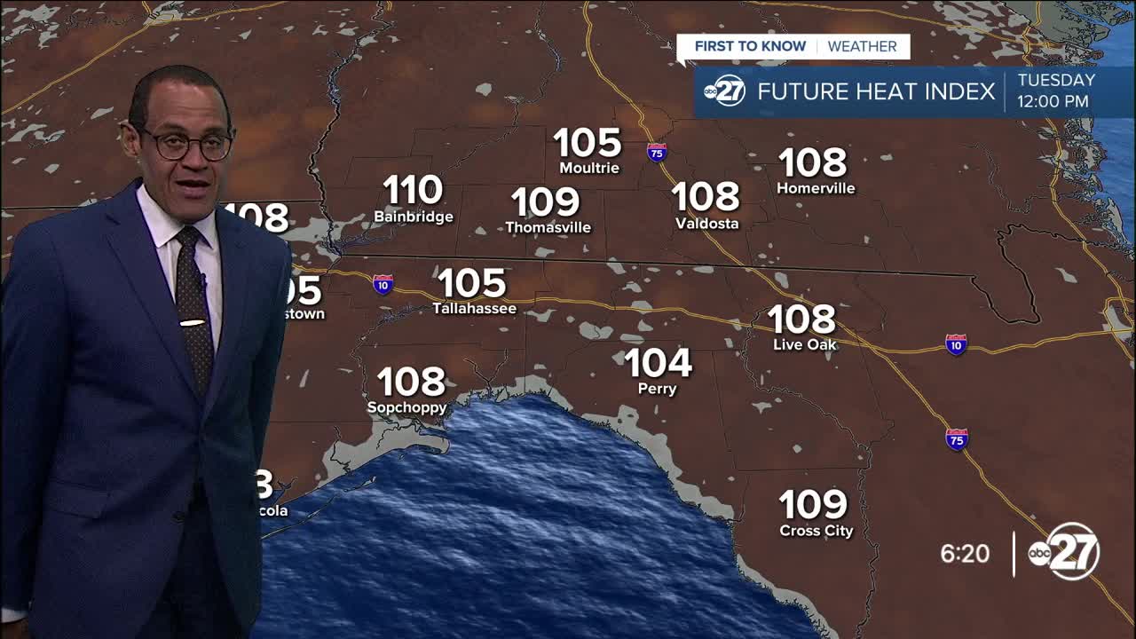


TALLAHASSEE, Fla. (WTXL) — Late-July scorching heat, supported by nearby high pressure, has pushed many neighborhoods toward 100°, as the feels-like values have easily been at or above 110°, validating the need for heat advisories. We can see them reissued tomorrow as we are in an extreme heat watch for Tuesday.
There isn't much promise for rain or storms today. An ever so brief shower can't be entirely impossible to see, but only a tiny part of our area would receive such an event.
Heat will linger deep into the night, with 90s through 8 or 9 p.m., 80s well past midnight, and lows in the upper 70s under a mostly clear to clear sky.
The high-pressure feature will shift slightly west Tuesday, and the heat and local wind flows will support a few more pop-up scattered afternoon showers and storms. Depending on timing and location, this slight increase in rain activity can prevent most areas from hitting 100° again, but some will still get close. Upper 90s will be common for highs.
With thunderstorms that form in this type of environment, downpours will cause locally strong wind gusts, though broad severe weather isn't going to happen.
There's evidence of slightly less moisture around the region at midweek, and a different position of the heat-wave high-pressure ridge, so while readings will remain in the middle 90s for most of this week locally, a slight chance for a few showers and storms will be present each afternoon. By the weekend, deeper moisture reconnects to the area as a front slides close by, activating more clouds and showers with patchy thunderstorms.
—Casanova Nurse, Chief Meteorologist
Want to see more local news? Visit the WTXL ABC 27 Website.
Stay in touch with us anywhere, anytime.
