


TALLAHASSEE, Fla. (WTXL) — As the tropical low moves farther away from our area, the deepest moisture feed will decrease somewhat. We will still stay humid for the foreseeable future, but some changes to the pattern will promote a drop in rain frequency and an overall increase in the heat leading into the weekend.
Small-scale showers and rain will affect spots in the tri-state and the I-75 corridor this evening, with isolated thunderstorms early this evening. It will be partly clear to partly cloudy elsewhere throughout the night ahead.
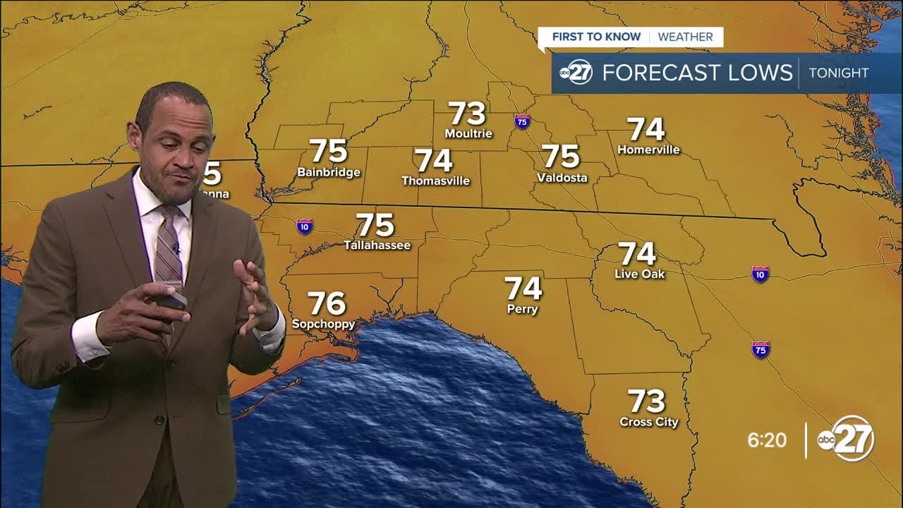
Evening readings will fall through the 80s through midnight, leveling off in the mid 70s by sunrise.
Friday will appear to be a classic July day in the state line region, with a blend of sun and clouds in the morning leading to developing scattered showers, downpours, and thunderstorms moving north in the afternoon, with forecast highs in the low to middle 90s.
Those highs over the weekend will bump up into the upper side of the 90s, supported by increasing high pressure along the central Gulf region and the Deep South, along with local winds coming from the west. We'll likely have isolated to widely scattered showers and storms Saturday and Sunday with feels-like values near or in the heat advisory range, at or above 108° in the peak of the afternoon.
--Casanova Nurse, Chief Meteorologist
Want to see more local news? Visit the WTXL ABC 27 Website.
Stay in touch with us anywhere, anytime.
