TALLAHASSEE, Fla. (WTXL) — A pattern that supports the development and movement of stronger disturbances this week will give the Florida/Georgia line region more opportunities for showers and thunderstorms.
Current forecast trends suggest chances for gusty and severe thunderstorms will be higher with this week's storm system compared to last week.
The next round of rain and storms moves into the region Monday evening, with the approach of a warm front overnight into Tuesday. This will bring the chance for scattered storms Monday night, with damaging wind gusts and an isolated tornado possible, especially in western portions of the viewing area. A second round of storms moves into the region Tuesday morning ahead of a cold front, and this line of storms will pack a bigger punch than storms Monday night.
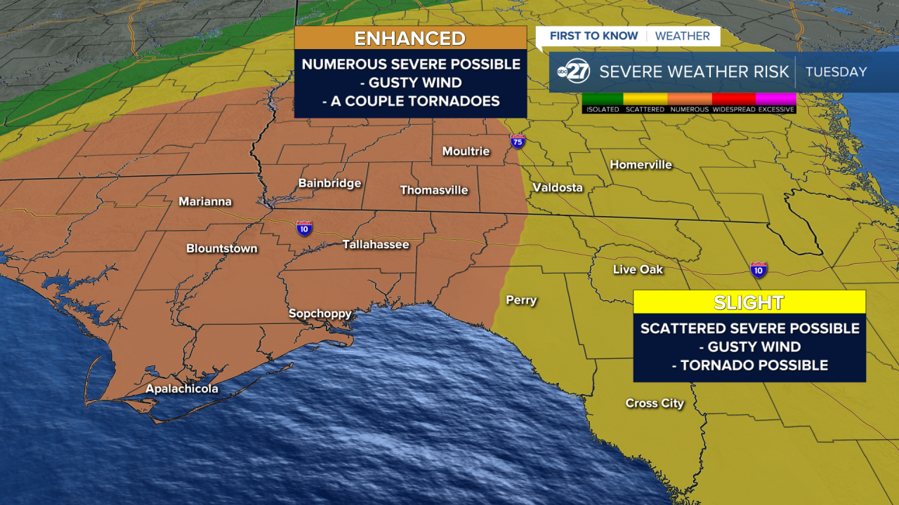
Right now, a 3/5 numerous risk for severe weather exists on Tuesday in central and western portions of the viewing area, including Tallahassee, Bainbridge, and Moultrie. While lower, a 2/5 scattered risk for severe weather exists for the rest of the region, encompassing western areas including Valdosta, Perry, and Live Oak.
The biggest impacts expected with this line of storms on Tuesday is the potential for damaging wind gusts with a couple tornadoes, some of which have the possibility of becoming long-tracked. It is important to have multiple ways to receive alerts heading to bed Monday night into the day on Tuesday in case a tornado warning is issued for your area, and one of those methods should be to keep tuned to First To Know Weather, as we will continue to update you of any impending dangerous storms on air and online.
In addition to the tornado threat, heavy rain is expected as the line of thunderstorms moves through the region Tuesday, bringing the potential for flash flooding to the region. High surf along the coast is also expected, with dangerous marine conditions as the storms move through.
We are in the time of year when organized severe-weather events that lead to tornadoes tend to occur in the Deep South and the tri-state area. Severe storms are not guaranteed for all local counties, but disturbances anticipated over the next seven days can keep our weather outcomes a bit more unsettled than not.


