


TALLAHASSEE, Fla. (WTXL) — I'll say it once, and I'll say it again... this is not your typical South Georgia/ North Florida summertime heat.
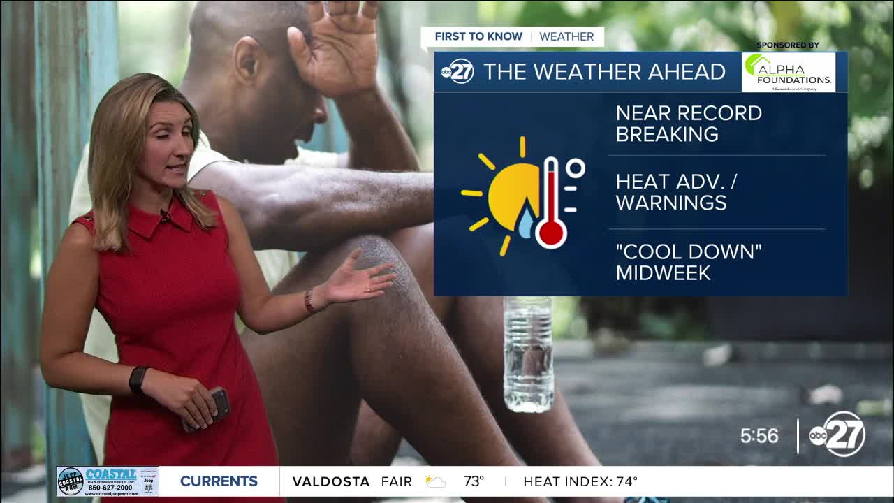
Highs could reach or top records on Monday, but heat index values will climb even higher!
The forecast high in Tallahassee Monday is 101 which would tie a previous record set in 1993.
Even with a drier northwest wind, some humidity still is around... well, because we live in the southeast.
So those triple digit highs could feel more like the triple digit teens (108-114 for parts of our area).
Hamilton, Clinch, and Echols counties are under an Extreme Heat Warning. 'Feels like temperatures' could be close to 114-degrees Monday afternoon.
The rest of our neighborhoods are under a Heat Advisory with heat index values climbing as high as 110-degrees.
With hot air and humidity, it is hard for our sweat to evaporate efficiently. Evaporation (a cooling process) of sweat is how we keep cooler during hot summer days. Without efficient cooling, we can overheat quickly.
It is important to know the warning signs of heat stroke and heat exhaustion (see weather graphics above for more information).
Want to see more local news? Visit the WTXL ABC 27 Website.
Stay in touch with us anywhere, anytime.
