


TALLAHASSEE, Fla. (WTXL) — A big cool down is in store Monday, but stormy weather will come first.
We are currently tracking a line of storms just off to our north and west that will eventually make it's way to our area at around 3-4 p.m..
The storms packed within the line are on the stronger side and have high chances of becoming severe with the main threats being gusty winds and possible tornadoes.
A Tornado Watch is in place for Seminole, Miller, Decatur, Baker, Mitchell, Grady, and Colquitt counties until 7 p.m. Sunday night.
The line will take it's time moving though our area, but will weaken as it does so. So the highest chances for severe weather are for central and northwestern neighborhoods.
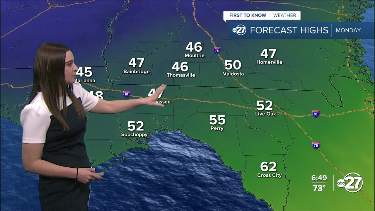
Once we get behind the front, temperatures will take a significant drop Monday with highs staying in the 40s. Monday night lows will drop to the 20s with wind chills in the teens. Multiple cold weather advisories are in effect for Monday night.
Want to see more local news? Visit the WTXL ABC 27 Website.
Stay in touch with us anywhere, anytime.
