


Update 1/30/2026 as of 10 A.M:
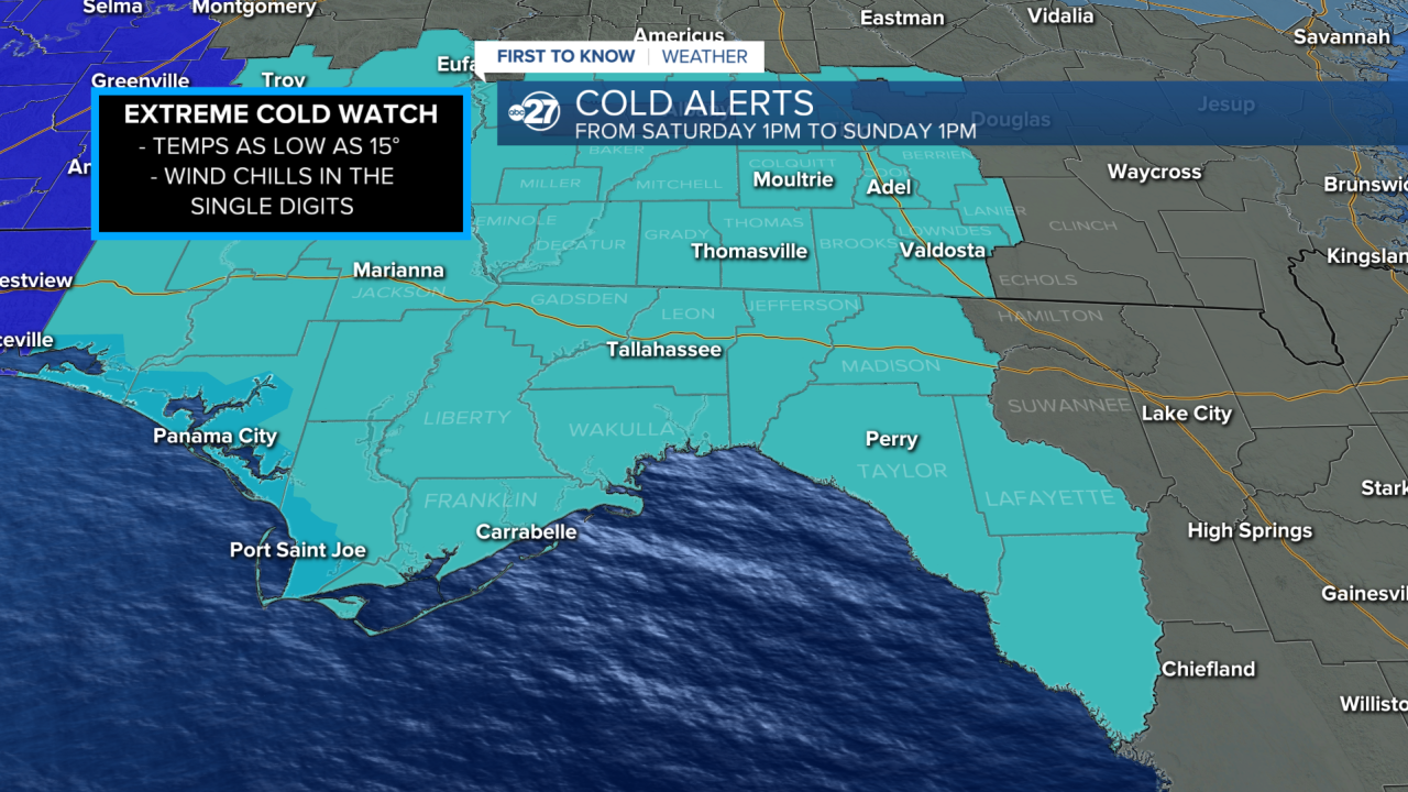
We are in an Extreme Cold Watch but this will be upgraded into an Extreme Cold Warning by this afternoon. With the latest model update there will be fewer single digit wind chills for the entire area Sunday morning. That being said many will still experience single digits, especially in south Georgia.
Wind chills now range from 5°-15° instead of 1°-15°.
Original posted 1/29/2026
While temperatures before this weekend will actually warm slightly, they will crash back down with another dose of extreme cold. If that was not bad enough, strong winds will make things feel even colder throughout this weekend. The most important thing to remember during this cold event is to Cover Your Skin. At these extreme temperatures, frostbite can set in only 30 minutes.
Saturday AM:

Wind will start to pick up Friday evening, and overnight, this is also when the first of the arctic air will be settling in. Wind gusts will begin to speed up starting Saturday morning, with many areas around 20-25 mph at 7:00 a.m. as we start our day. Around the coastline, gusts could already reach 30-40 mph.

As the cold air is starting to settle in, the wind chills will not be at their worst for the event. In fact, many will still be warm enough to stay in the 30s. The further west you are, the faster you will get that colder air, including the teens and low 20s for the wind chills. Temperatures at this time will be in the upper to mid-30s, excluding the wind chill.
Saturday PM:

Saturday afternoon is when the winds will hit their peak. The gusts will also be at their highest levels around this time, continuing into the evening. They will likely peak on average around 25-30 mph. Winds around the coastline and over the gulf will be around 40-50 mph.

The warmest time of the day is 4:00 p.m. However, with these strong wind chills, the actual highs in the low 40s and upper 30s will feel like the teens and 20s. In fact, the entire day Saturday from start to finish will feel temperatures usually only reserved for overnights and mornings in our area.
Sunday AM:

Overnight, the winds will start to weaken, fully returning to calm conditions by Sunday evening. The morning, on the other hand, will still have strong gusts on average around 20-25 mph as we start our day at 7:00 a.m.

Sunday morning is also when we will have the harshest, most brutal wind chills for the entire event, possibly even our entire winter. With lows during this time in the teens and low 20s, the wind chills could be in the single digits. There is even a chance that some could feel below 0° through our South Georgia counties.
Want to see more local news? Visit the WTXL ABC 27 Website.
Stay in touch with us anywhere, anytime.
