


TALLAHASSEE, Fla. (WTXL) — Saturday has been filled with cloud cover and a few showers for western neighborhoods, but the rain will extend eastward overnight.
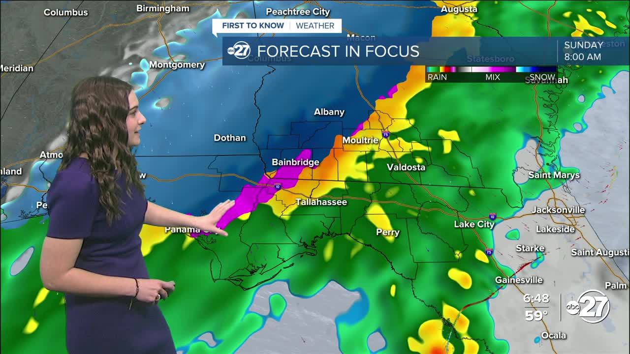
The cold front is currently moving through the area, but more showers are expected after the front passing. The coldest air will arrive Sunday morning and temperatures will get to freezing for a brief period. If everything lines up with the temperatures and moisture, there is a possibility for mixed precipitation/snow for a brief period of time in the morning hours (anywhere from 5 a.m. - 10 a.m.).
As models are becoming more consistent through Friday night and Saturday, snow is looking more promising, but still not guaranteed at this time. If any snow is to fall, it is not expected to have any major impacts. Due to warm temperatures Saturday and temperatures quickly warming Sunday late morning, the snow will either melt as it hits the ground or quickly melt afterwards. The only accumulation would be on grassy areas and could add up to 0.5" - 1".
A Winter Weather Advisory is in place for Jackson, Seminole, Decatur, Miller, Baker, Mitchell, Colquitt, Tift, Cook, and Berrien counties from 4 a.m. to noon Sunday as these counties have the highest chance of seeing any winter weather.
Any precipitation is expected to end fairly quickly by noon - 1 p.m. and will be followed by sunny skies in the early evening with highs in the mid to upper 40s.
We want to emphasize that the forecast is likely to continue to change and nothing is set in stone yet. A lot of things have to align perfectly for winter weather with this system. We will continue to update you both on air and online.
Want to see more local news? Visit the WTXL ABC 27 Website.
Stay in touch with us anywhere, anytime.
