

ENTER DATELINE — A chilly start to the day is underway across the region with temperatures in the mid 30s just before sunrise. Skies are mostly clear with a mostly sunny sky expected to continue throughout the daylight hours. This will help warm temperatures through the 40s and 50s this morning, with afternoon highs reaching the mid 60s.
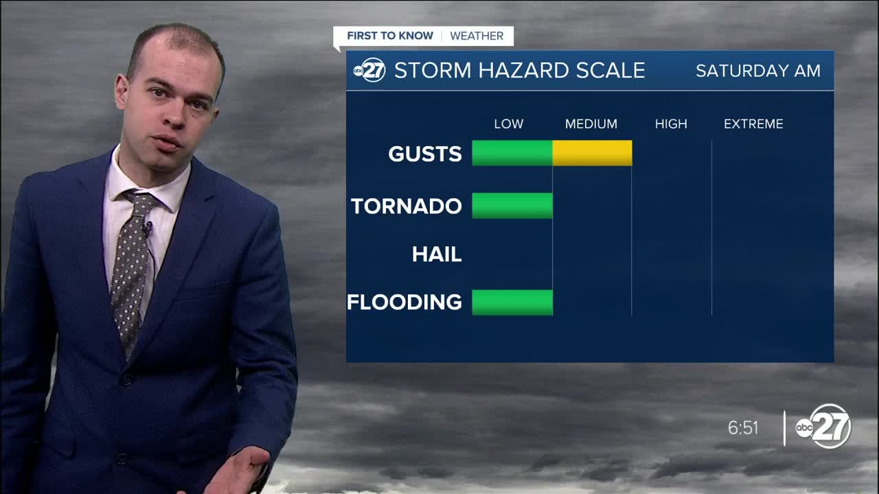
After sunset, scattered storms will move into the region from west to east. The radar will begin to fill in with widespread heavy rain and thunder after midnight, and will last through sunrise tomorrow morning. This will bring the potential for damaging winds and an isolated tornado that cannot be ruled out, so make sure to have multiple ways to receive alerts overnight while you are sleeping. 1-3 inches of rain can be expected across the region overnight, meaning some localized flooding is possible, but it is not expected to be a widespread concern. Increased humidity will keep lows in the upper 50s overnight, well above average.
By 9 am tomorrow morning, rain will have moved out of the entire region, and a partly cloudy day will be underway. Highs tomorrow rise into the low 70s, making it a great day to get outdoors and enjoy the warm weather. Highs into early next week will stay in the 60s with overnight lows in the 40s before another severe weather threat comes into play Monday night into Tuesday. This system looks to be stronger than the one moving through overnight tonight, meaning there is a greater chance for damaging winds and a possible tornado. We'll continue to track the severe weather threat for tonight and early next week here at First To Know Weather, stay tuned the next couple of days as we fine tune the forecast!
