

TALLAHASSEE, Fla. (WTXL) — The heat is on yet again this afternoon, with temperatures across the region maxing out in the upper 90s to low 100s. A Heat Advisory is in effect for the majority of the region through 8pm EDT, with Wakulla, Liberty, and Franklin counties under an Excessive Heat Warning. This is because feel like temperatures are exceeding 108 degrees this afternoon, with some areas experiencing a heat index of over 113 degrees. Some isolated storms are popping up on the radar in western portions of the viewing area this afternoon, but most will be brief in nature, and do little to help break the heat. Overnight, lows will dip into the upper 70s, with most of the region on the mostly clear side.
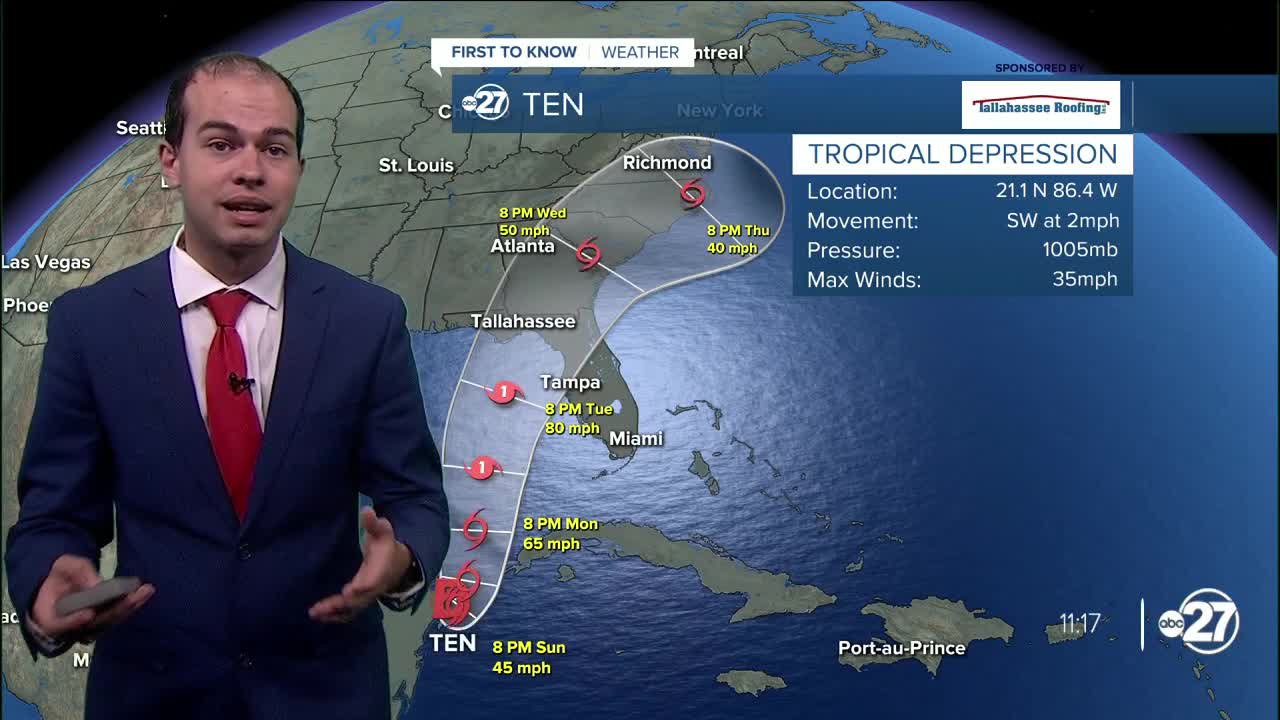
Tomorrow, temperatures will remain toasty, with high temperatures yet again reaching the upper 90s. However, a stationary front along a low pressure system will approach the region from the west in the afternoon, helping to enhance rain chances, especially in western portions of the viewing area. Scattered rain chances with high temperatures in the upper 90s return to the forecast Monday afternoon, before impact from a tropical system come into play Tuesday into Wednesday. This will help enhance rain chances and break the heat, as what is expected to become Idalia will approach our region. It is too soon to know exact impacts from this future storm, so make sure to stay tuned to WTXL for the latest on the storm's strength and track.
