

Today's high temperature in Tallahassee reached 99 degrees, just 1 degrees of June 9th's record high of 100 degrees set back in 1993. This weekend has brought the hottest weather of the year so far with lots of sunshine continuing for the rest of the day. Overnight, a few clouds will begin to filter into the area as temperatures dip through the 80s before midnight, falling into the low 70s by the early morning hours.
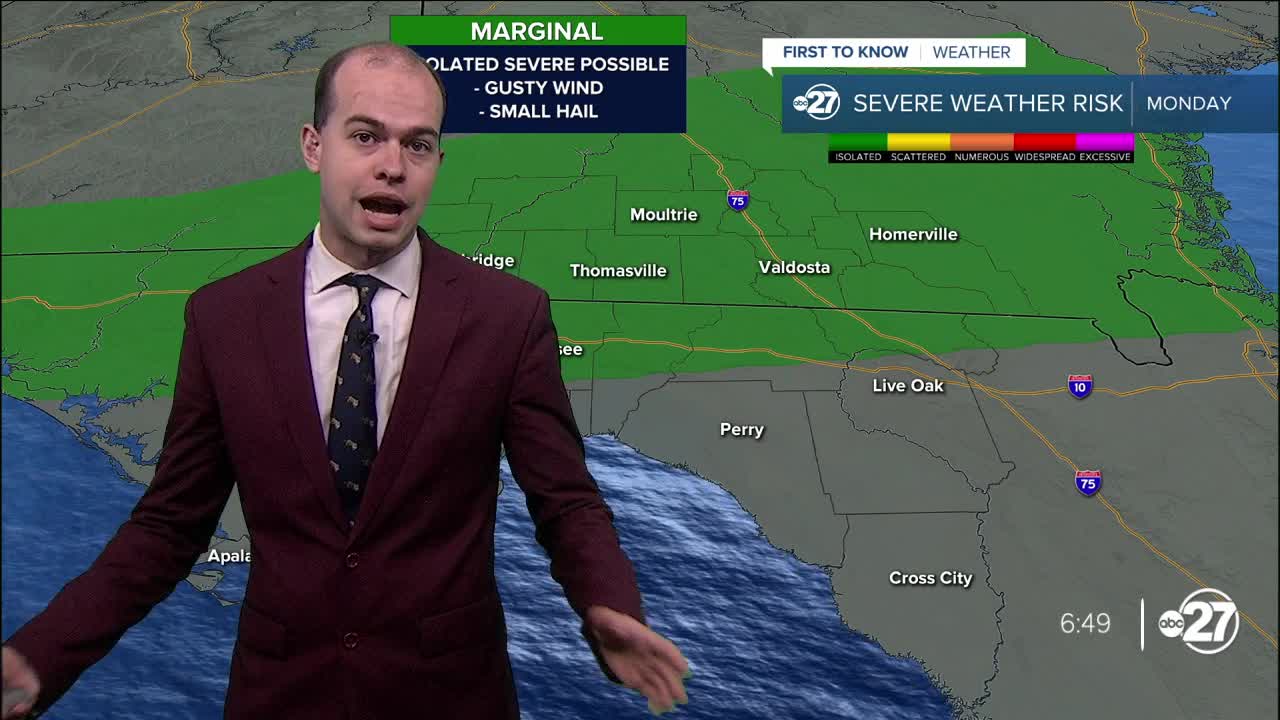
Humidity starts moving back into the area overnight tonight, with skies remaining mostly sunny Monday morning. By the afternoon, highs will reach the mid 90s as isolated storms pop up across the area during the mid to late afternoon hours. A storm or two could reach severe limits bringing the chance of damaging wind and small hail, but no tornado threat is expected with these storms. The chance for severe storms is greatest along the I-10 corridor and areas northward.
Tuesday looks to be the driest day of this upcoming workweek, and while an isolated pop-up storm is possible, anything that does form will be brief and localized in nature. Rain chances bump up each day throughout the rest of the week, with scattered storms across the area Wednesday onwards. This will help keep highs in the upper 80s and low 90s, but it will be important to keep the umbrella or rain jacket handy when you venture outdoors.
