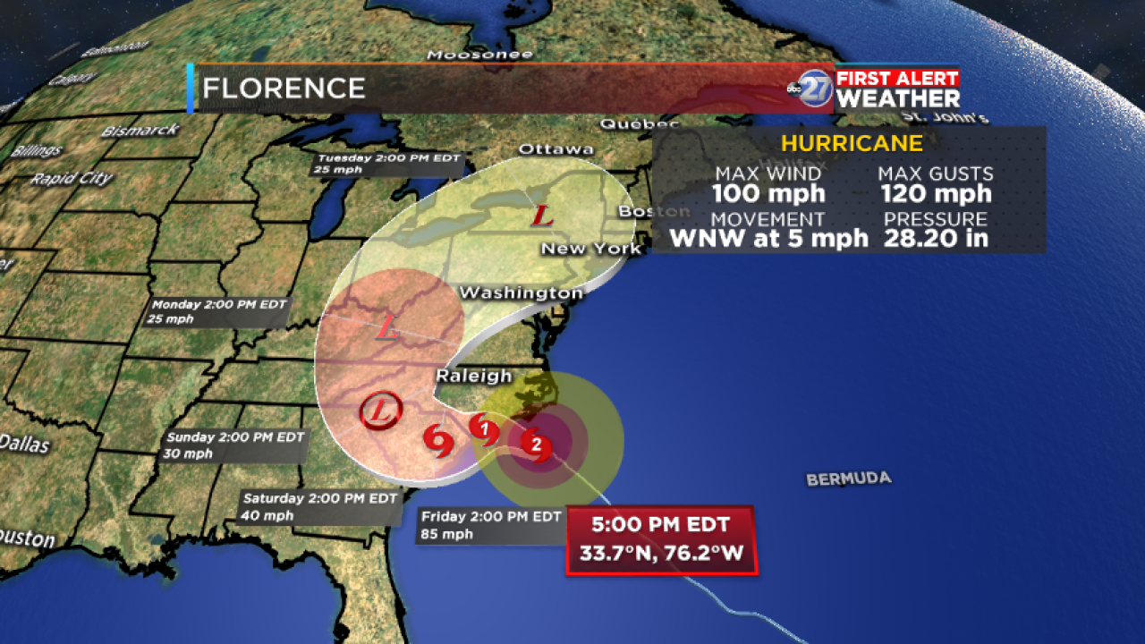

MIDWAY, Fla. (WTXL) -- Hurricane Florence is slightly weaker wind-wise than it was a day before, but big wind and water impacts are beginning to be experienced along the Atlantic shore.
Florence is less than 100 miles from Wilmington, North Carolina with peak winds of 100 mph. It is moving northwest at a slower pace of 5 mph.
Florence's wind force will change little during its flirtation with the South and North Carolina shore. Devastating wind and storm surge is likely along the same stretch of coast, especially if Florence meanders offshore or drifts to the west or southwest. The slow and somewhat erratic motion of Florence will prolong maximum wind and rain impacts for the immediate coastline.
Flooding rain is possible for the Carolina coast, as well as inland parts of the mid-Atlantic and perhaps even northeastern Georgia, depending on where the leftovers of the hurricane move in the Southeastern U.S.
Florence's effects in the local area will be indirect, and mainly in the form of drier air and northerly winds (which will be well below storm force), setting up a dry, warmer pattern for northern Florida and southern Georgia this weekend.
