


ENTER DATELINE — A mild day is wrapping up across the Big Bend and Southern Georgia, with temperatures across the region in the low to mid 50s just before sunset. A partly cloudy sky will make way for increasing cloud coverage overnight, as temperatures drop into the 40s. Overnight lows will dip into the upper 30s for much of the region, even as skies become cloudy nearing sunrise tomorrow morning.
Tomorrow will begin with cloudy skies, and temperatures will struggle to make it out of the 40s throughout the morning. Skies will remain mostly cloudy throughout the day, with highs reaching the low 60s before sunset. Isolated showers will approach the region during the late morning, with showers becoming more widespread in nature during the mid afternoon time frame. By sunset, scattered areas of rain and thunder will move into the region, with a small chance that some storms can reach severe limits from areas Tallahassee west.
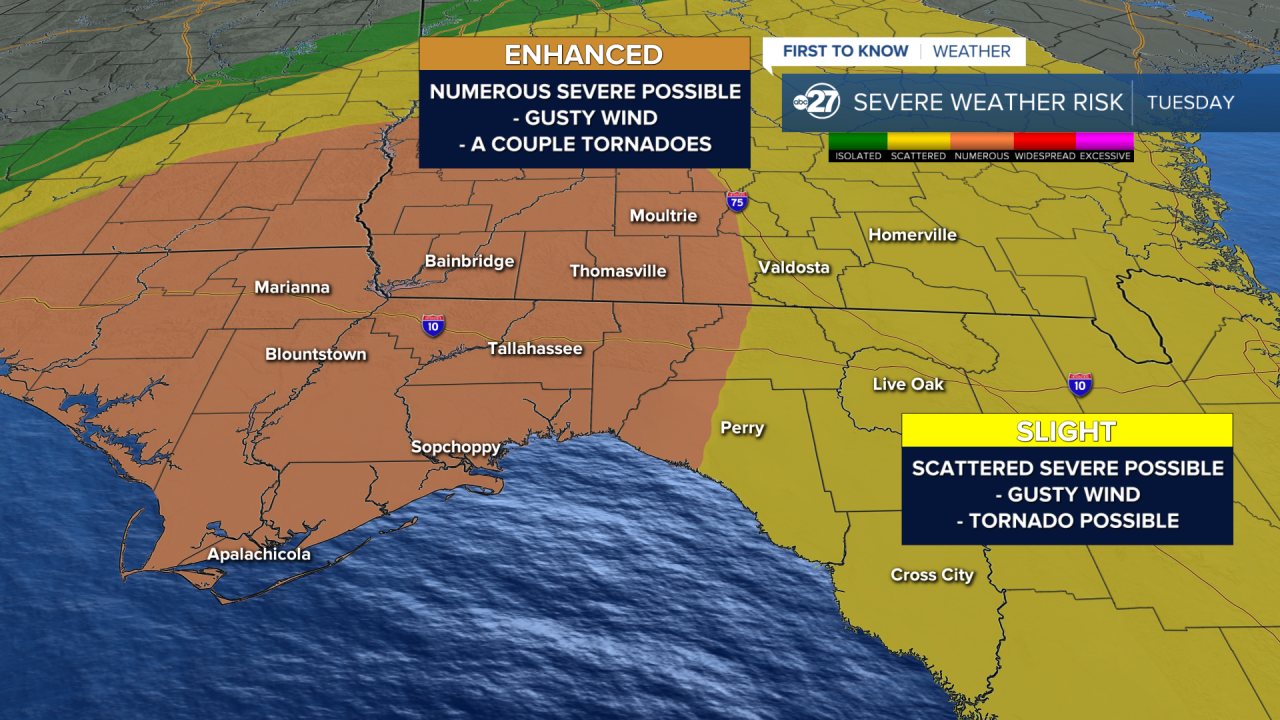
Another round of storms will approach the region following sunrise Tuesday morning as wind from the south brings in warmer and more humid air. Skies will remain cloudy Tuesday morning, but a potentially significant severe weather risk will shape up for the mid morning through mid afternoon hours as a line of storms moves in from the west. Damaging winds with a couple tornadoes, some potentially long-tracked, are possible, especially in central and western portions of the viewing area. For this reason, a 3/5 numerous risk for severe weather is expected for areas including Tallahassee, Bainbridge, and Moultrie for the day on Tuesday. Stay tuned with First To Know Weather for updates on Tuesday's severe weather event, and have multiple ways to receive warnings in the event a tornado warning is issued.
Skies will clear out and cool down for the day on Wednesday, with highs in the 50s and overnight lows dipping into the 30s. The next chance at storms comes on Friday as highs return to the 70s, and while lower than Tuesday, a severe weather threat is still possible. The weekend will then feature below average temperatures with partly cloudy skies.
